Update Aug 7th: Due to low turnout, we are cancelling this trip. Don’t know if it was the date, the fires, COVID, or a mix of these, but only one person ended up signing up. The trip certainly looks like a good one, so we’ll definitely run it next spring/summer!

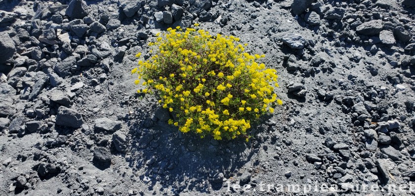
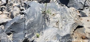
Devils Postpile Hotsprings flowing into Hot Creek Lupin flowers Looking west from Hot Fish Creek area Devils Postpile tops Devils Postpile tops Yellow flowers on obsidian dome Hot Creek Fish Hatchery Obsidian with plants growing out of it. Obsidain Dome at campground Mono Lake Tufas Earthquake fissure Hot Creek above the hotsprings

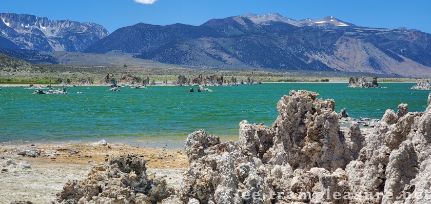
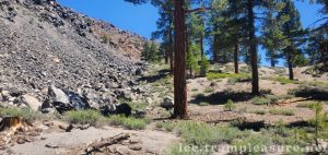
The Eastern Sierras provide unique geological and environmental features. On this trip we will see towering columnar bassalts, boiling water hot-springs draining into a local stream, an earthquake fissure, and the carbonate tufas of Mono Lake. Hiking will be on Saturday and Sunday, with camping Friday and Saturday nights.
Fire and air quality update
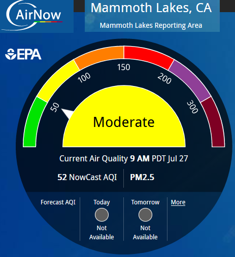
The Oak Fire near Yosemite has been producing smoke that may be carried over the Sierra to the area we will be visiting. As of August 1, the fire is 74% contained, and the air quality in Mammoth Lakes area remains in the “Good” range. We will keep you updated here, and if you register but need to cancel, you will be fully refunded.
Registration can be found here or at the bottom of this page.
Map
The map on the right (or below on phones) shows all our locations for the weekend. If you click the icon in the upper left corner, a legend will open for the map.
In this weekend trip, we will visit geologic features around Mammoth Lake/Mammoth Mountain. Destinations include
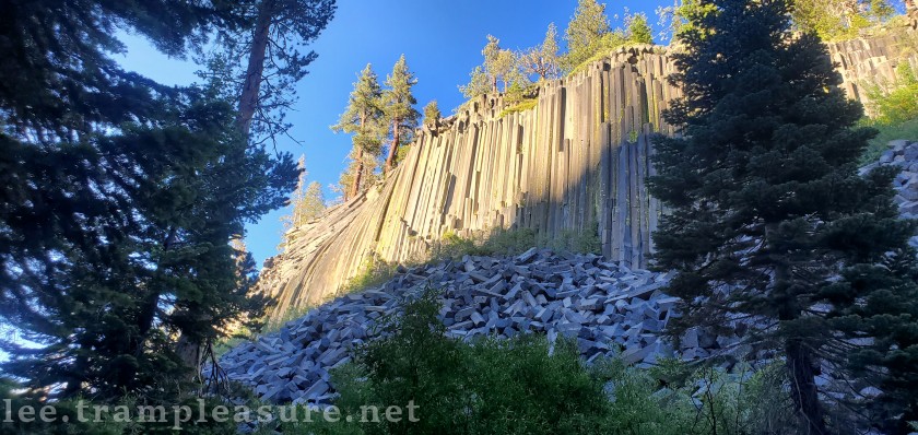
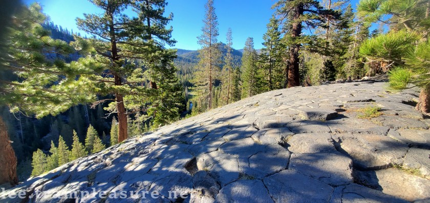
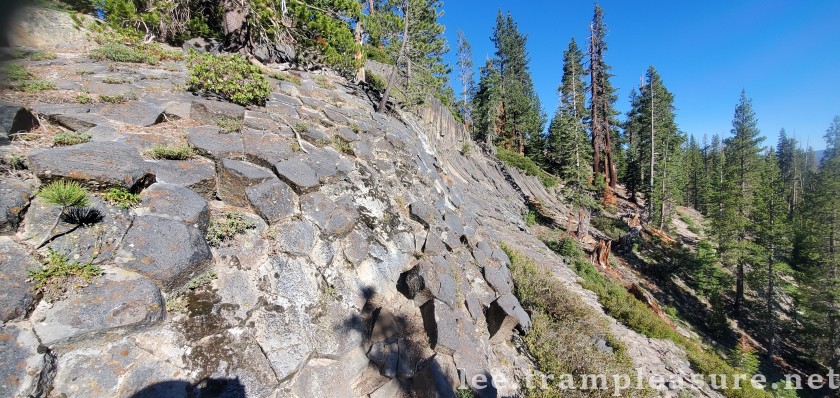
- Devils PostPile (60 feet columnar basalt)
- These columns were created as a pool of lava cooled)
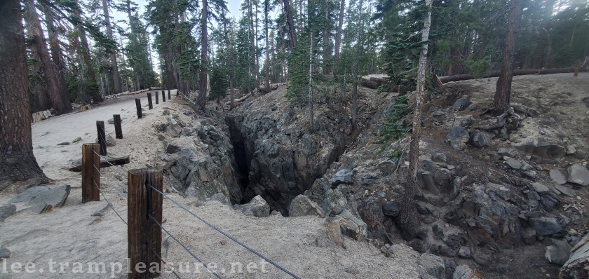
- An earthquake fissure that is about 10 feet wide and 60 feet deep
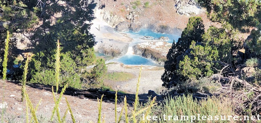
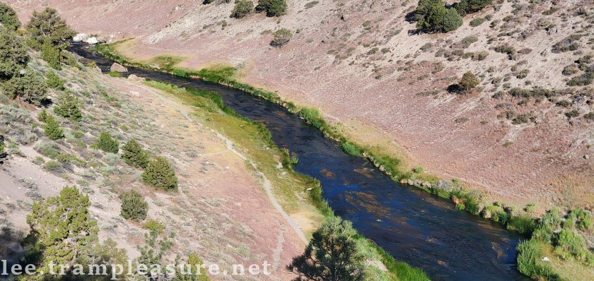
- Hot Creek Geologic Site where boiling water enters a small stream
- Hot Creek Trout Hatchery
- Mono Lake Tufas (optional, on the way home Sunday)
Camping and overnights
We’ll have campgrounds for folks, but if any individuals/couples want to find hotel rooms nearby, there will probably be some available in Mammoth Lakes. If you opt for a hotel, you’ll be on your own to find us in the mornings, but we’ll always be within about ten miles from Mammoth Lakes. Cell phone service seems to be good in most areas, especially for texting.
Altitude, weather, daylight, bugs, & bears
- We will be sleeping and hiking between 6,000 and 8,000 feet. This means you may want to hike slower (there is less oxygen in the air) and sunburns are more likely.
- Historic average high temperature is around 85°F and low of 53°F. We’re not likely to have heavy rain, but it won’t hurt to bring a light rain jacket in your day pack.
- Daylight is from around 6:15 AM till 7:50 PM.
- Some of our locations may have mosquitos. Be prepared to defend yourself with repellent if you tend to get bit.
- The area is considered bear territory (oh you Cal fans are happy!). This doesn’t mean it’s likely that we will see any bears, but food must be kept safe from bears. Our campsites have bear lockers to store food in. If you have a bear canister for food, it won’t hurt if you bring it, but you shouldn’t have to go out and buy one.
Cost
When you register for the trip, you will be provided methods to send us money.
Your contribution to our expenses is requested. Please donate based what you can afford, and what you think the trip is worth. Our goal is to provide outings that are affordable to all people, but we hope to cover our expenses and be able to bank a bit of money.
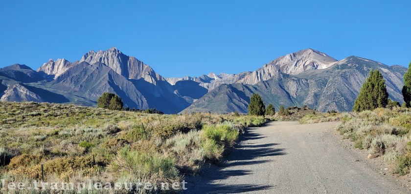
Driving, roads, and cars
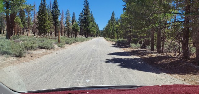
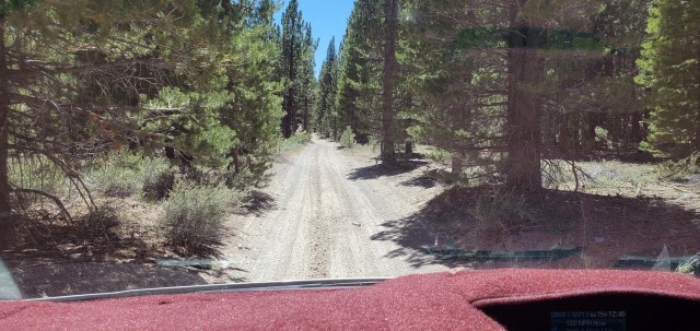
Some of the roads we will be driving on will be well-graded dirt/gravel roads; about five miles at most. Your basic front-wheel drive sedan car can handle them, although they are a bit dusty with mild washboarding.
Carpools
We’ve tried carpooling before, but it never seems to work out. If you’d like to try to find a carpool, please comment at the bottom of this post, on Facebook, or Meetup.
Weather predictions from today
Click here for August weather history
Bear Territory?
OK, I’m really a Cal dropout, so everyone is invited
Itinerary
All of our destinations are within about twenty miles of each other. I’ll provide GPS points for everyone so you can use your favorite app to help you find our destinations
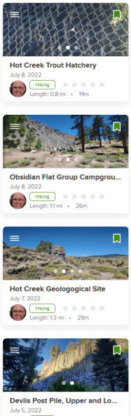
If you’d like to see all the hike maps, I’ve uploaded them all to an AllTrails list; if you’d like to have them on your phone, feel free to download them ahead of time.
Friday
Driving
Friday will be a driving day; we’ll gather in our campsite as people arrive in the later afternoon/evening.
Driving times, depending on traffic and your habits, are estimated by Google as follows:
- San Francisco/San Jose/Oakland (via Highway 120/395) : 5.5-6 hours.
- Sacramento (via Highway 50/88/89/395): 4.5-5 hours.
- Fresno (via Highway 120/395): 4.5-5 hours.
- Reno (via Highway 395): 3 hours
Camping
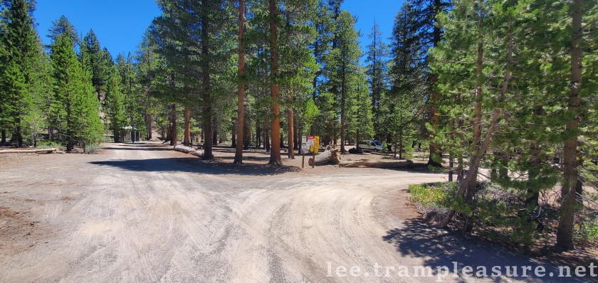
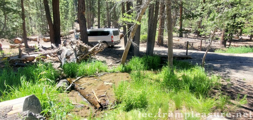
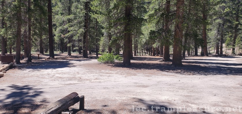
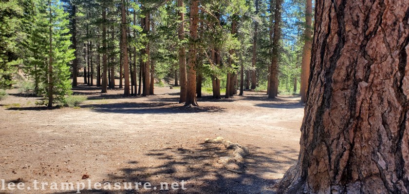
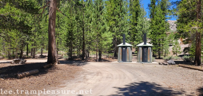
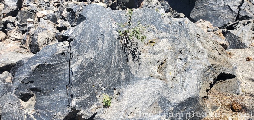
We have Obsidian Flat Group Campground reserved from Thursday-Sunday (if you want to arrive on Thursday, please let me know). This is a dry campground with only vault toilets, but it is a short walk from an obsidian dome we’ll be able to explore in the evenings. The campsite is about 4.5 miles down a well-graded gravel and dirt road–any sedan car should be able to make it.
If anyone has a self-contained camper (RV, van, etc.), they may opt for staying overnight at the Crestview Rest Area on Highway 395 (about six miles from the campground).
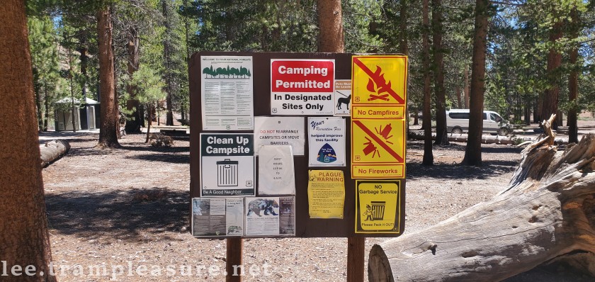
The campground does not have water, just vault toilets, so come prepared. Each site has picnic tables and bear boxes (this area is considered bear country, so keep your food in these bear-proof lockers).
Crestview Rest Area is located on Highway 395 about 1/2 mile south of Owens River Road, and water and flush toilets are available at the rest area. If anyone has a self-contained camper (RV, van, etc.), you are permitted to stay overnight at the Rest Area if that is your preference. Unfortunately, tents are not allowed in Rest Areas.
Saturday
Breakfast
Prepare breakfast on your own; everyone should be ready to leave by 8:30. Pack a lunch, and bring a day pack because we’ll be on the shuttle for most of our transportation today.
Main hike: Devils Postpile
We’ll drive to from the campsite to shuttle bus (around 15 miles and 30 minutes), then board the bus for the drive down into the valley that has Devils Postpile.
Everyone will need to purchase a $15 bus pass. I hope to be able to get reservations in advance for the 9:30 AM bus.
We’ll have two options for hiking: We’ll start with a half-mile hike around the Devils Postpiles (seeing them from below and looking at the glacier paved hexagons from the top); then those who wish a longer hike can extend it to about five miles to hike down to Rainbow Falls.
Bring lunch, snacks, and water on the hike.
The shuttle bus can pick up hikers lower in its route if some folks don’t want to hike all the way back to the beginning. Details will be provided in the morning.
Earthquake fault fissure
After the morning/mid-day hike, we’ll probably be in smaller groups depending on the length of the hike each person/group chooses. After riding the shuttle bus back up the hill, I recommend a stop at the this unique feature of the area.
The area around Mammoth Lakes has multitudes of faults, but this particular fissure is still very open (it opened 550-650 years ago). It’s a nice place to visit, with picnic tables and vault toilets.
Sunday
Breakfast
Breakfast is on your own, everyone should be ready to leave by 8:30. Today we’ll all be in our own vehicles.
Main hike: Hot Creek Geologic Site
This hike is under two miles; we’ll walk down to the hot spring, then up the stream a bit.
The water at the Hot Creek warm springs is so hot and unpredictable that visitors aren’t allowed into the stream it drains into, nor close enough to touch it. We’ll hike upstream a bit to explore other fumaroles that we can get up close and personal with (I’ll bring thermometers so we can see how hot they are!).
At the end of the hike up the stream, folks can walk back down the stream or take a path up to the road to return to the cars.
Optional late morning/afternoon
Depending on how far folks have to drive, each carload is welcome to join us on any or all of the following, or make their own choices.
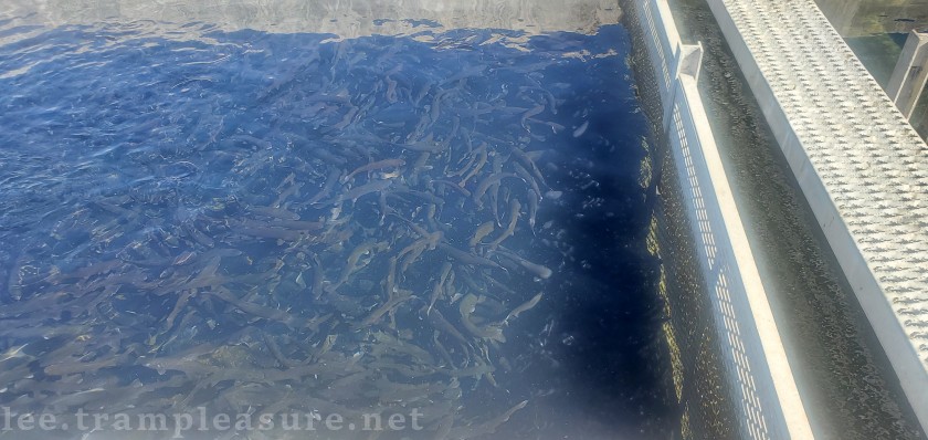
Hot Creek Fish Hatchery
The fish hatchery is run by the California Department of Fish & Wildlife and is open to the public daily from 9:00 AM to 3:00 PM. It is completely self-guided, although I ran into a couple of workers who were inoculating the trout who were happy to talk with me about the hatchery. We’ll be there on a Sunday, so there may not be any employees working.
It’s a nice walk, maybe a half-mile if you visit all the fish raceways.
Hot springs
There are a few open pool hot springs within a few miles of each other in the area (it’s Forest Service land, so open to anyone for free). There is no guarantee how hot or full each spring may be, but bring a suit if you’d like to explore and soak.
Tufa towers at Mono Lake
If you’re driving back to the north/west, Mono Lake is on your way home.
Conclusions and FAQs
This trip is designed to accommodate the novice hiker; most of the hikes have shorter options, and you can join us on any or all of the hikes/explorations. If you have extra time and want to add this trip to the start/end of a longer trip, please feel free to do so.
We’ll probably have between 10 and 30 people on this trip, so please register once you decide you are joining us. If you have any questions, leave them as comments below if they are generalized, or email me if you have a more personal question. You can also text me at 510-859-8533 (if you want a call back, I’ll probably reply from a phone number that ends in 7035).
The week before the trip I’ll send out my cell phone number to everyone attending. We’ve found that texting is the best way to communicate during trips, since texts go through once each way, but phone calls can get dropped on either end.
Please review our FAQ pages if you have any general questions about our trips.
Registration
[ESPRESSO_TICKET_SELECTOR event_id=760]


Great photos! O ski never graduated from Cal either! Bro Calvin
HI Bro,
Yes, but we’ve probably attended more Cal sporting events than any alumni 🙂
would anyone be interested in carpooling from Sacramento area If anyone is interested here is my cell: (805)-651-8359. I’d be happy to talk with people beforehand, plan out our trip, and or meet eachother in person if anyone is interested, to get rid of the unknown factor and for safety purposes.
My name is Ben
Hi Ben,
Good idea to get together ahead of time. Katie and I are in Davis, and we’ll organize a low-pressure optional gathering in the Sac/Davis area the last weekend of July or first of August.